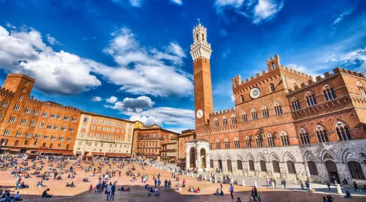
Skip menu
Spending your holidays by the sea in Italy means discovering iconic seaside resorts and landscapes. From the coves of Sardinia, to the glamorous resorts of the Amalfi Coast. Speaking of about 8 thousand kilometres of coastline with a variety of breathtaking, wild and pristine beaches. Dive into the gentle waves of the Mediterranean and let yourself be soothed by its crystal clear waters.
Sea 407 Search results
Nature
The island of Asinara

The island of Asinara

The island of Asinara: the long history of a magical place The Romans called it the Island of Hercules before it became a land of contention between the Maritime Republics of Pisa and Genoa, then domain of the Savoy, a place of confinement, leper house and prison. The island of Asinara has had a long and troubled history, but almost a century of isolation has made it a still unspoilt natural paradise. Today, a protected marine area to be explored on foot, by bicycle or boat, discovering the wilder and rockier west coast and shallow shores and sandy seabed of the east. Donkey Island According to legend, Hercules grasped the end of Sardinia with his mighty hand, tearing it from the mainland, hence the name, Herculis Insula. Later called Sinuaria for the wealth of gulfs and inlets on its 110 km of coast. Asinara is perhaps a mispronunciation of the Latin or perhaps it refers to the white donkeys that have lived there since time immemorial and still live free on the island. A story that begins in the Neolithic In the Campu Perdu area, in the north of the island is a domus de janas, evidence that these places were inhabited since the Neolithic period. A few wrecks found in the sea remain from Roman times. One is still visible a few metres from the jetty in Cala Reale. Over time, the island had to deal with Arab raids, later skirmishes between Pisa and Genoa for supremacy in the Mediterranean. It was the Ligurian Malaspina who built the Castellaccio here, which dominates the entire gulf from above. The pirate Barbarossa landed nearby to hide between robberies. In 1885, Asinara became a penal colony and the island's inhabitants had to leave. Many of them founded Stintino, then called Cala Savoia. Since then, the island remained inaccessible for over a century. Only since 1998, when the maximum security prison was closed, has it reopened to visitors. Asinara's most beautiful beaches Being a protected reserve, not all beaches on the island are accessible. These can only be admired from afar, Cala Sant'Andrea and Cala d'Arena. Caretta caretta turtles lay their eggs here. Cala Sabina can be reached via ancient mule track. It is 30 minutes from Cala d’Oliva. Near Cala d’Oliva are Cala Murichessa and Cala Giardino. Don't miss Cala di Sgombro at the narrowest point on the island: steep cliff with rough sea on one side, sandy seabed with a calm sea on the other. On foot, by bike, off-road... or swimming! The best way to immerse yourself in the Asinara National Park wilderness is to walk around it. But watch out for the sun: there is hardly any shade. Also bring sufficient water because there are only two cafes on the island. In Cala Reale you can hire electric bikes and cars, sailboats and canoes. Or book an off-road tour accompanied by Geomarine Environmental Guides. This is the only way to visit certain areas of the island like Cala Trabuccato and Punta Scorno. A visit to Asinara cannot be complete without a dip in its crystal-clear waters. Not only for a refreshing swim in the water in shades of blue to green, but also to observe the wonderful seabed populated by countless creatures: a snorkelling paradise. During a boat trip it is easy to spot dolphins, even sea turtles. Not only nature: what else to visit Although nature is the dominant feature, there are many human traces to be discovered around the island. In addition to the Neolithic Campu Perdu domus de janas and the Castellaccio ruins, several watchtowers built in the 16th century can be found along the coast. The Ossuary, built to house the remains of thousands of Austro-Hungarian prisoners during the WWI, dates back to 1936. In Cala Reale, there is the Royal Palace, former summer residence of the Savoy family. In Fornelli, you can visit the old prison.
Sea
Spiaggia della Tonnara

Scopello

Scopello and the Zingaro Nature Reserve, Sicily as it once was Scopello is a beautiful coastal village with an ancient history. It stands in front of a handful of stacks that emerge from the water and form a natural amphitheatre of reddish rocks that intensify the blue of the sea. Since at least the 13th century, there has been a tonnara (tuna fishery) concealed in the rock here, which was in operation until the 1980s. Today it is one of the most fascinating places in Sicily, the gateway to a protected area of great naturalistic value, the Zingaro Nature Reserve. The mythical city of Cetaria Like all places of great beauty, Scopello is associated with a myth: the city of Cetaria is said to have sprung up here, so called because of the abundance of fish in its waters (from the Greek word cetos, meaning sea animals such as cetaceans). What is certain is that the place has been inhabited since ancient times, when a population from Asia Minor settled on these shores after the Trojan War; the same people who probably also founded the city of Erice. The Scopello we see today dates back to the 17th century, when the Bourbon kings used the area as a hunting reserve. For centuries dedicated to heavy tuna fishing, in the last 40 years Scopello has now become a paradise for those who love the sea, thanks to its seabed rich in anemones, madrepores and gorgonians where you can dive and swim among amberjacks and tuna, shipwrecks and submerged archaeological finds. The Scopello tuna fishery Nestled between scenic stacks and a rock face, the Tonnara di Scopello is a truly enchanting place. Its construction dates back to the 13th century, when it was just a small, well-concealed building set against the rock. It was expanded in the second half of the 15th century, first by the San Clemente family from Trapani, then by the Society of Jesus, which also built the small church, and finally by the Florio family at the end of the 19th century. Tuna caught along the coast were processed and stored in the complex. Operations ceased with the last slaughter in 1984, and since then the tuna fishery has only been used for marine biology research work. Today, the Tonnara complex is accessible for a fee for visits, including guided tours, which allow visitors to retrace the history of tuna fishing and enjoy the Faraglioni beach. There is a diving centre in the complex, which also offers dinghy excursions along the coast. Scopello's beaches In addition to the Faraglioni beach, there are several beaches and coves on the Scopello coast where you can spend a day by the sea. Guidaloca beach is a large sandy inlet with easy access to the sea, well sheltered from the wind, where the sea is always calm. Here you will find a parking area and a bar, and part of the beach is equipped with deckchairs and parasols. Those who prefer deeper waters where they can snorkel may opt for Cala Bianca, a rocky and wild stretch of coastline, without beach facilities, that can only be reached on foot along a 700-metre path, or by boat from Castellammare. Close to the Zingaro Nature Reserve is Cala Mazzo di Sciacca, with very clear waters rich in sea life, ideal for snorkelling and diving. It can be reached by car and there is only a small bar. The Zingaro Nature Reserve, an environmental victory The Zingaro Nature Reserve stretches along the coast between Scopello and San Vito lo Capo in a series of sheer cliffs interspersed with coves that make it possible to reach the sea. It is one of the rare stretches of Sicilian coastline without a seafront: a road construction site was laid in 1976, but blocked due to protests by environmentalist committees that led to a full-scale march against the work, and in favour of safeguarding the territory, in 1980. The following year, the protected area was established. Today, the Reserve can be explored along three paths, formerly mule tracks, which are about 7 kilometres in total. There is a coastal one, which provides access to charming pebble beaches and the prehistoric Uzzo cave; a mid-coast path to visit Borgo Cusenza, a nucleus of farmers' houses, and the petrified forest; and a high path, which is more challenging and very scenic. Inland, there are three museums (one naturalistic, one dedicated to the sea, one to the peasant civilisation) and an environmental education centre, two equipped areas and some rural buildings in contrada Sughero used for bivouacs, which are only allowed from October to May by making a request to the Reserve management. In the highest part, there are woods of Aleppo pines and holm oaks alternating with Mediterranean maquis that is regaining possession of an area that was cultivated for centuries, and that today, thanks to conservation, is once again a treasure trove of biodiversity.
Islands
Favignana island

Favignana island

Favignana, the paradise island with a turquoise sea Favignana, the largest of the Egadi Islands, is a cluster of shallow bays with a turquoise sea, listed as a marine protected area. Its flat coastline makes it easy to get around on foot or by bicycle, so that you can discover a different beach every day. In what used to be one of the largest tuna fisheries in the Mediterranean, a museum has been opened in the harbour bay to retrace the history of tuna fishing. Beaches for all tastes Favignana's beaches can cater for all tastes and needs: that of Praia, near the harbour, Cala Azzurra, Lido Burrone, the Calamoni, in the south-east, are all mainly sandy. The coast of Punta Lunga, the Preveto and Faraglioni beaches, on the other hand, have sand mixed with pebbles. Cala Rossa, on the north-eastern coast, offers both rocks and sand, while Grotta Perciata, Punta Fanfalo and Cavallo are completely rocky. A Marine Protected Area The sea that laps Favignana is included in the Marine Protected Area (MPA) of the Egadi Islands, a marine park that is particularly important not only for its size (54,000 hectares, the largest in Europe), but also for its geographical position: the park is in fact the first point of arrival for algae and oceanic fauna that move with the Atlantic currents, a flow of water that rises to the surface just near the Egadi Islands with its important biological richness. The MPA aims to preserve the fauna, which is particularly rich in protected or vulnerable species, including the monk seal, bluefin tuna, sea turtle, dolphin, sperm whale, sharks, manta rays and various species of fish and molluscs. To enjoy the sea, take a boat with the local fishermen who organise excursions to the caves and fishing-tourism activities: many of them are former tuna fishermen who can tell you how the tuna fishing took place. The stone quarries of Favignana For centuries, calcarenite, improperly called tuff, a very compact, light-coloured building stone, was quarried on Favignana. The quarrying has left deep traces everywhere, particularly in the north-eastern area, of open quarries that, now abandoned, are used by the inhabitants to make vegetable patches and gardens protected from the wind where fruit trees such as figs, almonds and citrus fruits grow. Some quarries near the coast have become convenient descents to the sea or have created extravagantly shaped pools: where they are slowly being re-naturalised, they create striking environments. Go and see Cala Rossa, where quarrymen have left tall tuff columns that resemble those of a cathedral. What to do in Favignana On the island you can take long, easy walks both along the coast to explore the beaches, and in the hilly part towards the Fort of Santa Caterina, an ancient watchtower rebuilt by Roger II the Norman and later used by the Bourbons as a prison. Today it is an extraordinary observation point for the entire archipelago and the western coast of Sicily. Visit the museum built in the former Florio factory, one of the largest ancient tuna fisheries in the Mediterranean, which houses an exhibition with videos and evidence of tuna slaughter, as well as a room with archaeological finds. From the port of Favignana you can set off on an excursion to the island of Levanzo, where the sea is possibly even more transparent and inviting. On this island, of particular interest is the Grotta del Genovese, where a number of paintings and engravings dating back to the Neolithic period can be seen, including the silhouette of a tuna, an animal that has always been important to the communities that have lived on these islands. The cave can be reached on foot, but you must first contact the attendant at the harbour, or by boat. Fishballs, steaks or tartare: tuna is served The main ingredient of Favignana cuisine is tuna, which is fished between May and June and eaten as tartare, tasty fishballs or grilled steaks. There are also specialities such as spaghetti alla bottarga (tuna roe) and tuna carbonara. In the restaurants you will also find pasta with sea urchins, Egadi lobster and plenty of other fish, and there is no shortage of cous-cous, as is the case throughout eastern Sicily. For dessert, try the granitas in various flavours, also accompanied by brioches, cannoli and cassatas that go well with a glass of Marsala.
Sea
San Vito Lo Capo

San Vito Lo Capo

San Vito Lo Capo: the Sicilian Tropic On the north-western tip of Sicily, San Vito Lo Capo, with its three-kilometres beach of very light-coloured sand, ends where the Monte Monaco massif rises. Here, one of the island's most beautiful, protected areas, the Zingaro Nature Reserve, begins. Nature could not have been more generous to a place that retains important signs of its past where Arab and European cultures met and merged, continuing to do so today. Among ancient sanctuaries, wrecks and the remains of old tuna nets Almost an island within an island, San Vito Lo Capo lies on the green promontory enclosed by the imposing Mount Monaco to the east and Mount Cofano to the west. Visible in the middle of the countryside thanks to the small temple of Santa Crescenza, a place linked to the devotion of St Vitus. The Fortress Sanctuary, which dates back to the 5th century, is located closer to the sea: it is a fortified church that looks more like a bastion because the threat of the Saracens lasted for quite a while. Also worth a visit is the Tonnara del Secco, active until 1969, located along the path leading to the Zingaro Nature Reserve, behind Mount Monaco, 3 km from the centre: on the seabed in front of the tuna fishery, the wreck of the freighter Kent that sank in 1978, called the ship of the Korans because it is said to have carried holy books. On the west coast, towards Macari and Mount Cofano, dotted with numerous towers (Scieri, Mpisu and Isulidda), for swimming in the afternoon, then enjoy the sunset in the sea. There are no sandy beaches, but the descent to the sea between the rocks is quite easy. In the countryside, you can walk a long way towards Castelluzzo, among cultivated fields and olive groves. The Cous Cous Fest One of the most popular events in San Vito lo Capo is the Cous Cous Fest, celebrating the dish of Maghreb origin made from durum wheat semolina, also popular on the Trapani coast. A festival that went from being a culinary event to a moment of cultural integration celebrating the coexistence and diversity of peoples. Held in the last week of September since the late 1990s, it is a challenge for chefs from all over the world to prepare the best couscous. The side dish is a rich calendar of shows, cultural events, concerts alternating with tastings and visits to the area. Don’t miss the Couscuola, the couscous school, a thirty-minute lesson to return home with the rudiments to prepare this tasty dish that brings the two shores of the Mediterranean together. Mount Cofano reserve Unmistakable is the silhouette of Mount Cofano, in the territory of Custonaci, an area protected since 1997 by the nature reserve of the same name. The mountain is a steep-sided dolomite massif that was formed by the uplift of marine limestone deposits during the Triassic period. The ascent to the mountain is quite challenging, as its morphology suggests, but there is a very nice and easy path that goes all around the mountain, overlooking the sea. The Reserve's caves are interesting, with traces of prehistoric settlements, such as the Mangiapane cave in the Scurati locality, an 80-metre-high cavern, at the entrance of which are dwellings that were used until a few decades ago: one of Sicily's most evocative living nativity scenes is set here at Christmas. Also of interest are the 16th-century towers commissioned by the Spanish kings: from the San Giovanni tower you can see the panorama of the Egadi Islands, and the star-shaped one at the Tonnara di Cofano.
Sea
Punta Aderici

Punta Aderci

Punta Aderci, in the very heart of a nature reserve Beaches lapped by a crystal-clear sea in a natural setting of great beauty: this is one of the most striking stretches of coastline on the Adriatic Sea, in Abruzzo, in the protected area of Punta Aderci. Here your holiday is complete, in an interesting mix of seaside relaxation and the discovery of splendid scenery. A varied coastline of sand, pebbles and headlands. Environmental protection is a major strength The Punta Aderci protected area, the first to be established along the coast of Abruzzo, stretches 285 hectares from the Port of Vasto to the mouth of the Sinello River. Including the entire outer area, there are a total of 400 hectares of untouched wilderness. Every aspect of the environment is protected. Visitors are therefore urged to respect the flora and every single inch of this magnificent place. An amphitheatre by the sea One of the highlights of the reserve is the Punta Penna beach. It can be reached via a terraced path and is a long strip of sand in the shape of an amphitheatre, bordered behind by fascinating dunes. The beach is public and free of charge, making it suitable for everyone, including families with children. The Adriatic, here, is perfectly clear and the seabed is sandy and sloping, ideal for pleasant and safe bathing. With a stroke of luck, you might experience the thrill of swimming alongside sea turtles or even spot a dolphin in the distance in one of its spectacular leaps. After sunbathing, it is worth visiting the lighthouse. At 70 m high, it is the second tallest in Italy, after the Lanterna in Genoa. So, be patient and climb the 307 steps to the top. The effort is worth it: from up there, the view sweeps over kilometres of coastline and if it's a clear day, you can enjoy an immense panorama, from Ortona to the Gargano. From beach to beach Walking along the beach at Punta Penna, a pleasant stroll leads to another enchanted spot: Libertini beach. The fine sand gives way to pebbles, but the seabed remains sandy and shallow, speckled with small rocks. Legend has it that the name originates from events dating back a century. Apparently, nuns from the nearby convent used to come here to enjoy the sun and fresh air, revealing their legs and arms slightly. Libertine behaviour indeed! From here, up the steps, you reach the top of the spectacular cliff that protects the beach and then the headland of Punta Aderci, 26 metres above sea level. On the other side of the promontory is another charming little beach. Take a dip here, then continue on to Mottagrossa beach: the atmosphere here is one of perfect peace and quiet. Along the paths Starting at the pebble beach of Mottagrossa and ending at the mouth of the Sinello river, the boundary of the reserve, a wilderness area opens up, with 3 kilometres of scenic trails. You can travel on foot or by mountain bike, through cool pine forests, verdant valleys and broad stretches of Mediterranean scrub. It is best to take a map of the trails, which can be provided by the reserve authority. Towards the mouth of the Sinello river, you will come to the brick arches that once marked the route of the railway, and then the path that runs alongside the river begins. The richness of the fauna and flora Sea lilies, euphorbia, dune poppies, helichrysum and myrtle are the species that will accompany you during your stops by the sea. Flamingos, grey herons, egrets, kingfishers, hawks and sparrow hawks fly over the dunes, which can reach a height of 10 metres. If you are a keen birdwatcher, bring along some binoculars to admire the circling birds. The kentish plover has been chosen as the emblem of the reserve, as on the Vasto coast it nests on the beaches, laying its eggs on the ground. It is small, grey and white, and has a sort of black mask around its eyes and a small round head: you will see it wandering among the dunes in a display that is both tender and exciting. Don't disturb him as he patters about, pecking to feed on the small insects that he loves to eat. The trabocchi These are very special structures, a kind of stilt-houses used for fishing, typical of the stretch of Middle Adriatic coastline between Ortona and Vasto. Gabriele D'Annunzio, the poet of Abruzzese origin, called them “colossal spiders”. Many have been restored and are dotted along the sea. Some of them have restaurants and offer delicious fish dinners, suspended over the water.
Nature
Baia delle Mimose

Baia delle Mimose

In Sardinia at Baia delle Mimose, between fine sand and a thousand shades of blue Light, fine Caribbean-like sand and small clumps of bushes and wild flowers that conjure up images of beautiful deserts: yet we are not on the other side of the world, but in the incredible Sardinia that holds constant surprises in store for us. Welcome to Baia delle Mimose, a long beach on the border between Gallura and Anglona, amidst jagged cliffs overlooking the sea and the typical colours of the Mediterranean maquis. A holiday for the whole family Mimosa Bay is a corner of paradise that appeals to everyone: adults can indulge in lazing around in the sunshine, and youngsters enjoy long swims and organised games on the beach. The scenery is literally hypnotic, thanks also to the soft dunes covered with junipers and sea rosesagainst the backdrop of crystal-clear water, in a postcard-perfect setting. Not far from these small sandy mountains are a few small villas, a shopping centre with the main services, including a tobacco bar, a beauty centre, a boutique and an excursion point. The most popular destination for sportsmen The wind is constant at Le Mimose and this makes the 3 km long coastline perfect for wind and kite surfing. In addition, for those wishing to travel and explore the surroundings, its location is strategic: in fact, it is only 6 km from the town of Badesi, 70 km from Alghero and 80 km from Olbia. A small scenic paradise Among the many surprises Baia delle Mimose has in store is that it is not particularly crowded. This is how this beach, despite its limited size, remains an oasis of tranquillity even in high season. An advantage for tourists who want to spend their holidays in direct contact with nature and, at the same time, not stray too far from their residential centre. From here, one's gaze can sweep over the Isola Rossa in the distance in all its splendour and the outline of the Castelsardo promontory. A Blue Flag beach For its quality services, as well as the cleanliness of its waters, the beach has been awarded the Blue Flag continuously since 2017. The prestigious title was awarded by the Foundation for Environmental Education (Fee), after a careful evaluation including, among others, its excellent accessibility, the presence of parking, refreshment facilities and the possibility of hiring bathing equipment. What's more, even four-legged friends can enjoy a well-deserved holiday here. Not far from the mouth of the Coghinas river, there is a small 300 square metre beach with a dog beach, equipped with parasols, bowls and showers. Exploring the surroundings of Badesi The Bay of Mimosas is spectacular, but it is not the only gem in the area. Not to be missed is Li Mindi, with its clear sand and the possibility of catching a glimpse of Corsica and Asinara in the distance on fine days. No less interesting is also Li Junchi, with its golden sand and often windy, so perfect for surfers. Past the mouth of the Coghinas river, another naturalistic treasure awaits: Valledoria, with the seaside hamlet of San Pietro a mare, with its dunes covered in Mediterranean maquis, stretches of vegetation and a seabed perfect for diving and snorkelling.
Ops! An error occurred while sharing your content. Please accept profiling cookies to share the page.