Landing at Porto Corallo

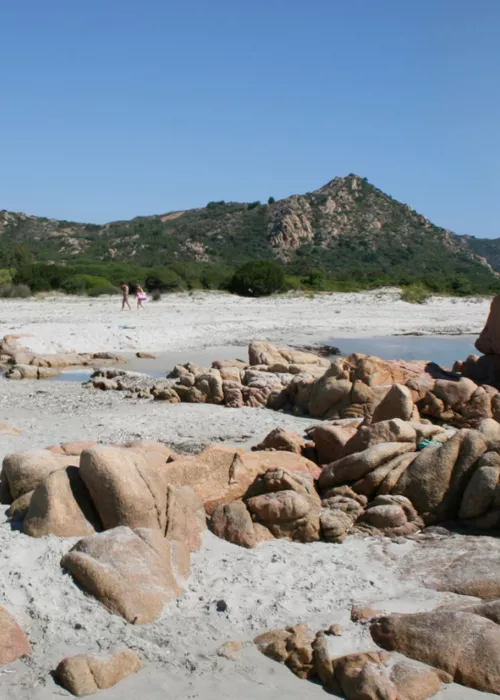
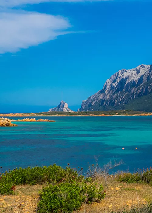
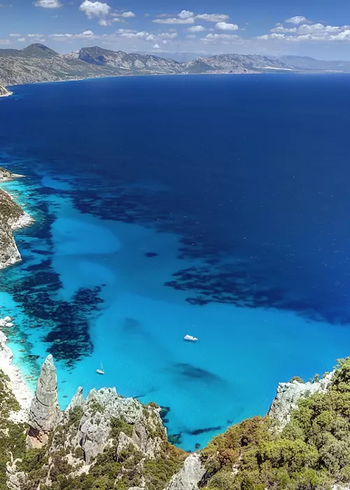
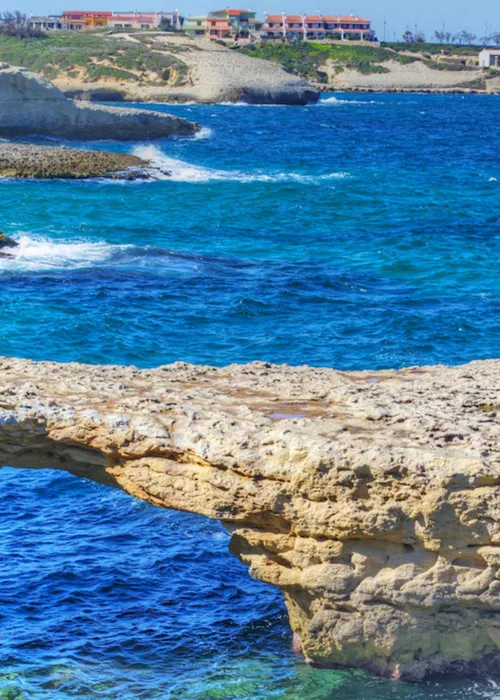
Sailing along the suggestive Route of the Giants and the Emerald Coast, which winds through the crystalline waters from Cagliari to Porto Cervo, you reach the charming marina di Porto Corallo, located in the municipality of Villaputzu. Known for its hospitality and modern services, this tourist port is a true paradise for sea lovers. It offers a wide range of accommodation, two specialised workshops and all the equipment needed to practise water sports such as windsurfing, sailing, kite surfing and diving. The first thing that catches your eye as you enter the harbour is the imposing Torre di Porto Corallo, a historic structure that dominates the landscape. Built to defend the coast, the tower offers a breathtaking panoramic view of the sea and surrounding hills, taking visitors back in time. Just a few steps from the marina, the coastline offers quiet beaches and hidden coves, ideal for those seeking moments of relaxation or outdoor adventure. Porto Corallo beach, with its golden sand and clear sea, is perfect for a sunny day. In the surrounding area you can explore nature trails immersed in the Mediterranean scrub, ideal for hiking or mountain biking.
Villaputzu, the town where Porto Corallo is located, has a history and traditions rich in charm. Its origins go back to the ancient Phoenician-Punic river port of Sarrapos, from which the region of Sarrabus takes its name, and which has its roots in the 7th century BC. It later became an important Roman centre, as attested by the Itinerarium Antonini. The heart of the present town is built around the church of Santa Caterina d'Alessandria. Not to be missed is the church of San Giorgio Martire, a late Gothic building rebuilt in the 16th century on an original 12th century structure. This corner of Sardinia, between the sea and the green hills, is the ideal starting point to discover the historical region of Sarrabus. Among unspoilt beaches, historical sites and natural landscapes, Porto Corallo and its surroundings promise an authentic and fascinating experience, inviting every traveller to discover the wonders of the most genuine Sardinia.
Quirra, land of the passage, land of the border

From Porto Corallo, you can set off to discover Sarrabus, travelling about 15 km north of the suggestive Strada Orientale Sarda, to reach the historical sub-region of Quirra, a place full of contrasts and suggestions. Quirra is an area of passage and frontier, where uncontaminated nature offers one of the wildest landscapes on the eastern coast of Sardinia. In this area there are real pearls to be discovered. The beach of Murtas, with its clear quartz sand, is enclosed between the promontories dominated by the Tower of San Lorenzo and the Murtas Tower. An ideal place for those seeking a relaxing day, immersed in a world of sea, sun and silence. It is the ideal place for those who want to spend a relaxing day immersed in a world of sea, sun and tranquillity. Behind the beach is a wetland of great naturalistic value, recognised as a Site of Community Importance (SCI) and part of the Natura2000 network. A system of footpaths allows you to explore this protected area, which has an exceptional biodiversity. Quirra is also an area steeped in history. During the Giudicale period, its lands were the scene of the legendary chronicles of Countess Violante Carroz, who went down in history as the “bloody countess”. From here you can also reach the inland mountainous area, characterised by rugged shapes, with Monte del Castello di Quirra, where the ruins of the ancient fortress stand out. The medieval charm of Quirra is enriched by the Church of San Nicola, located a few kilometres from the castle along the former SS 125. Probably built by the Pisans in the first decades of the 13th century, it is the only example in Sardinia of Romanesque architecture made entirely of terracotta bricks. Surrounded by a garden of olive trees and holm oaks, the little church is an oasis of peace, perfect for a break in the shade of the large trees. But the history of Quirra goes back much further: continuing north along the old SS 125, past the village of San Giorgio, at km 88,400, you will find the dirt road that leads to the Sacred Well of Is Pirois, a Nuragic architectural enigma. In this mysterious place there is a perennial water source embedded in a wall structure surmounted by a tower built on the pseudo-dome of the well. In the middle of the floor of the tower, a hole allows the sun's rays to illuminate the pool of water below, creating fascinating plays of light. A great mystery surrounds its function, and the plays of light created on certain days of the year give rise to various theories that link the sacred nuragic wells found all over Sardinia to ancient cults, to unimaginable astronomical knowledge of our ancestors and to rituals capable of predicting a rosy or nefarious future for rural life. Quirra offers a journey through time, between uncontaminated nature and ancient history, in a landscape that still retains its authentic and wild charm.
Baccu Locci and Pranu Trebini

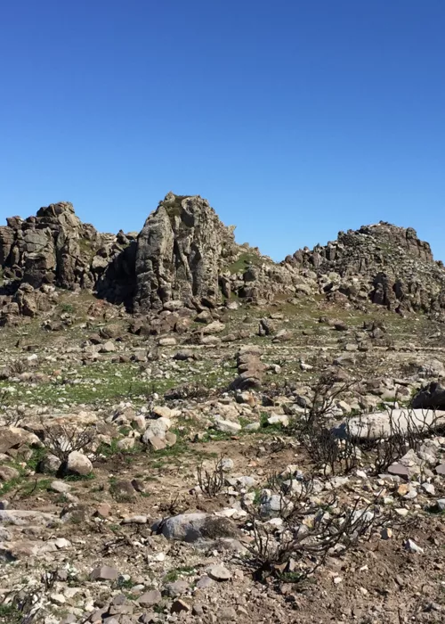
Continuing along the old SS 125 Orientale Sarda, just north of the Quirra Castle, you reach the Corr'e Cerbu bridge at km 82. From here a dirt road, which can be taken by mountain bike or car, begins that follows the bed of the river and heads inland. After a few hundred metres you can stop to admire the remains of the "Tomb of the Giants Bruncu Pedrarba". This archaeological site, which dates back to the Middle Bronze Age (1700-1500 BC), is immersed in the silence of the Mediterranean scrub and offers a suggestive plunge into the past. After about ten kilometres, you reach the village of Baccu Locci. This mining complex, in operation until 1965 for the extraction of arsenopyrite, preserves the remains of about thirty historical buildings and numerous industrial installations for the extraction of the mineral. The village is situated in a landscape of rare beauty, characterised by deep valleys and typical Mediterranean vegetation. Several paths cross the forest and lead to suggestive points along the streams that flow through the valley. Among these, the Su Strumpu de Pardis waterfall is a natural spectacle of intense colours, where the waters of the Baccu Locci stream makes an impressive leap. The itineraries are not particularly difficult, but they can get lost in the vegetation and have accesses that are not always easy to see. It is therefore advisable to use local guides. Near the car park overlooking the mine's washing plant, there is a gorge equipped for canyoning, with seven descents and two pools to dive into which represents another opportunity for extreme sports enthusiasts. Continuing along the same dirt road, you reach Pranu Trebini, a natural monument of great visual impact. This area is characterised by a series of rocky formations, carved by erosion, which have given rise to columns, arches, passages and towers, evoking the image of a "rock city", the name by which this place is known. After an intense day of sport and long walks, the area offers several options for accommodation. You can choose between a classic hotel, glamping in tents suspended between the trees, or several agritourisms immersed in the surrounding countryside for a unique experience in contact with nature.
Waterways: from the wells in the village of San Vito to the mines in the surrounding area

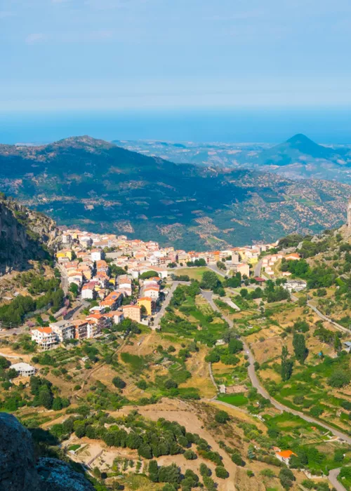
Leaving Quirra and heading south, you can easily reach San Vito in a few minutes on the new SS 125 or, if you are on two wheels, on the old Orientale Sarda. Getting lost in the streets of this small town is an authentic and exciting experience of Sardinia. In fact, San Vito has maintained an intact historical centre, preserving architecture ranging from Campidanese to Liberty, the latter a legacy of the area's flourishing mining past. The town boasts many portals, typical of the local architecture, well maintained over the years and still able to guard real treasures made up of gardens, small museums such as the old pharmacy or the personal museum of Luigi Lai, master of Launeddas. Several religious buildings in the town are worth a visit: the 13th century church of San Lussorio, on the top of a small hill, is unique among the churches of southern Sardinia, both for the type of decorations painted on the main nave and for the unit of measurement used for its construction: the "Byzantine foot". An interesting and well-marked urban itinerary will allow you to discover the many "is funtanas" of the settlement, some of which had a collective and public use, others were private or perhaps shared by two or three families. Following this itinerary, you can immerse yourself in the historical centre, following the narrative thread of the water, until you reach the banks of the Flumendosa river, crossing a large area of citrus groves, among which you can find the famous late San Vito orange, a variety typical of the area, which produces very juicy, seedless fruit with a high sugar content, and which arrives late in relation to the typical seasonality of oranges, being available and ripe on the plants between May and June. The mining past can be found in the town centre, not only in the stately homes that marked an era of economic prosperity, but also in a museum dedicated entirely to this element of Sarrabus's history. After a visit to the mining museum, a stop at the remains of the mining village of Brecca is a must. This intense day ends with a return to San Vito to taste the local cuisine, simple and genuine, enriched by a thousand flavours, including that of the "prazzira", a typical San Vito pizza made with simple but skilfully mixed ingredients. The historic centre also offers a dense network of micro-hotels, set up in elegant villas, where you can rest before continuing your journey.
Waterways: From San Vito to Torre Salinas

After waking up, leave San Vito by car or bike and head towards Torre Salinas. This town, south of Muravera, is famous for its Torre Salinas, a historic coastal tower that stands majestically on a promontory overlooking the sea. The trip to Torre Salinas is also the perfect opportunity to discover Muravera, a picturesque village immersed in the natural beauty of Sardinia. Muravera is famous for its lively atmosphere and traditions, including the famous Sagra degli Agrumi, which celebrates the area's symbolic fruit with events and tastings. In the town centre you can visit the church of San Nicola, a historic building, and the "Donna Francesca Sanna Sulis" Museum of Women's Entrepreneurship (MIF)", which displays local handicraft products and is also a venue for temporary art exhibitions. Continuing towards Torre Salinas, the landscape is enriched with natural wonders. The old salt mine, now abandoned, offers an interesting insight into the economic history of the region. Nearby, the Colostrai pond is an oasis of biodiversity, famous for being a favourite destination for pink flamingos. Finally, the adjacent beach, with its wild and uncontaminated beauty, is an ideal destination for a regenerating break in the midst of nature.
Waterways: from Torre Salinas to Torre di Porto Corallo

To return to Porto Corallo, starting from Torre Salinas, it is possible to follow the fascinating “Cammino 100 Torri”, which winds along the coast to the Torre di Porto Corallo. This easy-to-moderate itinerary follows the coastline, offering spectacular views and direct contact with nature. The itinerary is ideal for those who love walking in the open air, with the possibility of enjoying the sea views and rich biodiversity. The route begins with a short walk to the Torre dei Dieci Cavalli, the first stop on the walk. This historic tower, dating back to the Aragonese period, is a point of cultural interest and can also be reached by car, bicycle or, during the summer season, by a convenient shuttle service that departs from Muravera and arrives at the beach of San Giovanni. Continuing northwards along the beach you will come across the San Giovanni fishpond, an important area for local fishing. It is advisable to contact the managers of the fishpond before crossing the canal between the sea and the lagoon, which is within the boundaries of the fishpond itself, in order to obtain the necessary permits and instructions. Continue on to the Flumendosa estuary, where the river meets the sea in a varied and evocative landscape. On the rare occasions when the estuary is open, the route along the beach to Porto Corallo may be interrupted. In this case, it is necessary to go inland, passing through the villages of Villaputzu and Muravera. Along the way you will cross the SIC (Site of Community Interest) Foce del Flumendosa, a large wetland area of about 700 hectares. This area includes canals, water bodies and the Sa Praia pond. The natural habitat of this area is particularly rich and varied, with numerous species of amphibians, reptiles and birds. It is a privileged place for birdwatching, with the possibility of observing pink flamingos, herons and other migratory birds. In addition, the scenic beauty and tranquillity of this area offer a unique experience for nature and photography lovers. Finally, we return to Porto Corallo, which, with its welcoming atmosphere and natural beauty, is the ideal conclusion to this itinerary to discover the historical region of Sarrabus.


