Bastion Saint Remy, Cagliari

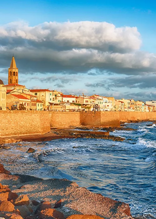
It is in the Castello district, overlooking the city from above. For the locals, the bastion represents the entire city, as this ancient rock has seen so much of the island's history. Stroll through the narrow streets, enter the many local craft boutiques, , admire the historic palaces and don't forget to pay a visit to the beautiful churches. Enjoy the panoramic views fromBastion Saint Remy: from here you can see the Marina and Stampace districts, as well as the port and even Poetto beach. First, take in the city from below with a visit to the lively Piazza Costituzione, then climb the long flight of steps or take the panoramic lift at sunset as the light fades, casting a pastel shade on the façades of the houses. Or else on a Sunday morning, when the outdoor craft market fills the streets, with stalls selling handcrafted wares, photographs and collectors' items.
Walking in the Marina district

Designed by the Pisans in the 13th century, along with the Castello, Stampace and Villanova districts, Rione Marina is one of the oldest neighbourhoods in Cagliari, right in the heart of the city. Marina is the first point of access to the city from the port, and was once the haunt of fishermen, sailors and merchants. As the point of arrival for many travellers from distant countries, this area has long been a melting pot of different cultures and traditions. Even today it retains a lively and fervent atmosphere, perhaps more than other areas. Wear comfortable shoes, because here, you go up and down between fun narrow alleys, encountering boutiques, craft shops, galleries, banks of colourful fabrics and spices, ethnic bars and traditional restaurants, literary cafés. Then there are the Church of San Sepolcro (Gothic-Catalan in origin, its large Baroque chapel of the Pieta was added in the 17th century) and the archaeological area of Sant'Eulalia with the Treasure Museum which holds valuable works from the churches of Sant'Eulalia, San Sepolcro and Santa Lucia. Finally, there is a little secret that needs to be revealed: the inhabitants of the Marina were ironically called 'Culus Infustus', or soaking butts (in the harbour water), but don't tell the locals!
Sanctuary and Basilica of Our Lady of Bonaria

The sanctuary is located on thesummit of the Bonaria hill (i.e. 'good air') a little outside the city centre, 1 km south-east of Via Roma. It was founded in 1324, when during the siege of the Pisans, King Alfonso of Aragon decided to camp on the hill and build a church and castle there. A pilgrimage destination from all over the world, the faithful come here to give grace to Our Lady of Bonaria, a wooden sculpture of the Virgin and Child hidden in a niche behind the high altar, who, according to legend, is said to have saved a ship of Spanish sailors from a storm in 1370. So strong was the devotion, thatin 1536 the Spanish conquistador Pedro de Mendoza named the current capital of Argentina 'Puerto de Nuestra Señora de los Buenos Aires' in honour of the shrine in Cagliari. Next to the sanctuary is the monumental basilica dating from 1704, which has been remodelled several times and in a piecemeal fashion (work was only declared completed in 1926).
If these tales of war and miracles have intrigued you, from Viale Diaz walk up the splendid wide staircase (often used as a scenic catwalk for fashion shows) leading to the basilica square and, before entering the church, stop in the square to admire the evocative panorama of Cagliari and on the sea.
The Molentargius Park

Perhaps this is the place one does not expect, the one that surprises most of all. Because if it is true that nature, in Cagliari, has been very generous, equally true is that finding a pink flamingo colony a stone's throw from the city underground is a rare thing, very rare indeed. The Molentargius-Saline Regional Natural Park, established in 1999 and covering over 1600 hectares, is a recognised wetland of international importance. It comprises basins of fresh water (Bellarosa minor and Perdalonga) and water of different salinity (the ponds of Molentargius and Quarto) divided by a plateau of sandy origin (Is Arenas). This whole ecosystem allows for the survival of different plant and animal species particularly the pink flamingos (they call them 'sa genti arrubia' here, the red people) that first nested here in 1993. Take advantage of the free trails within the area to discover this unique natural heritage and observe its inhabitants up close.
The Poetto beach

According to the people (the Cagliari people, of course), Poetto is the city beach par excellencethe chosen one in short. From spring to late summer, it is here that the people of Cagliari come on their lunch break or after a working day to indulge in some well-deserved time for relaxation but also in the evening, for dinner at a restaurant or to attend evening events. The coastline stretches for approximately 8 km, from the Devil's Saddle headland all the way to the Quartu Sant'Elena coastline, it can be reached by public transport from the city centre and is also served by a cycle path that runs not far from the sea. The popularity of the beach arrived in the first decades of the 20th century, with the construction of the tram line (think: the various sectors into which the beach is divided are called 'stops' because they correspond to the stops that the tram once made) and the emergence of the first bathing establishments; then the wind blew away the dunes and the construction industry shrunk the sandy shore by dint of building, but the beach is still lovely, well equipped and with kiosks aplenty. So, beer(strictly Ichnusa) in hand, sink your feet into the sand, and enjoy the scenery, with the emerald green sea and the pink beach at sunset, a feeling so pleasant that you will remember it for a long time.


