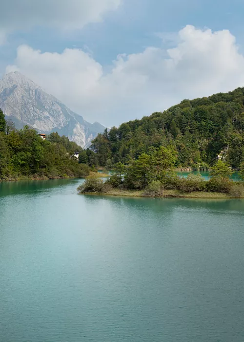
The Tarvisio area
This is the far north-east of Italy, on the border with Austria and Slovenia, and is a symbol par excellence of encounters and divisions. Three mountain ranges intersect here, while the rivers are divided between those that flow into the Adriatic and those that flow into the Black Sea. The thousand-year-old Tarvisio Forest is one of the most important wildlife corridors in Europe, where a high concentration of different species of mammals, birds, amphibians, reptiles and insects coexist. Biodiversity also applies to humans and their cultures: the three main European language groups give rise to the four different languages spoken in this area (Italian, Friulian, German and Slovenian). Finally, the cuisine also combines the typical dishes of the three borders in a mix of Central European and Italian traditions. One of these mountains is also the origin and namesake of a prized DOP cheese, the pride of regional gastronomy: Montasio.
The first entirely Italian stage of the Alpe Adria Trail begins in Valbruna, the starting point for exploring Val Saisera: this is where the resonance spruce trees grow, whose highly prized wood is selected for the construction of musical instruments all over the world. You then climb Mount Lussari (1,790 m): your efforts are rewarded by a fantastic view of the entire Julian Alps mountain range that stretches across the triple border. At the top of Lussari is a fairytale Marian shrine, a traditional pilgrimage destination for Italian, Slovenian and German worshippers. For the return journey, you can follow the pilgrimage route down to the valley and then on to Tarvisio, which is the main centre in the area and one of the most important ski resorts and mountain sports centres in Friuli- Venezia Giulia.
The next stage leads to the Zacchi Refuge through the charming valley of the Fusine lakes. The landscape changes throughout the year: nature draws on an infinite palette of colours, giving the woods and lakes a unique chromatic quality that makes the place even more magical. Further afield, the Julian Alps reveal their wild and rocky side. Although they do not reach 3,000 metres, they already have all the characteristics of high altitude at lower altitudes. This allows them to offer views and trails that are accessible to everyone and, at the same time, to be a real paradise for mountaineers.
The itinerary continues towards Slovenia and then returns to Italy a little further south, in the Natisone Valleys.
The Natisone Valleys
The section of the route that passes through Italy runs along the ridge of Mount Kolovrat, which is perhaps the most beautiful stretch of the entire route: on one side, there is a breathtaking view of the Julian Alps, while on the other, there is a splendid panorama of the Adriatic Sea and the subsequent stages leading down to the sea.
During the First World War, Kolovrat was the scene of fierce clashes between Italian and Austro-Hungarian troops. The Italian army built its third line of defence in this area; the remains of these fortifications can now be visited in a significant open-air museum.
Descending from Kolovrat, you enter the Natisone Valleys, four valleys that are still unspoilt and therefore almost wild, with streams flowing steeply between spectacular gorges and caves and woods of native chestnut trees. Chestnuts are associated with countless recipes and events, such as Burnjak, the great chestnut festival in Tribil di Sopra. Between one valley and another, you will come across small villages with typical stone houses and 15th-century churches in the Slovenian Gothic style. Despite its historical ties with Italy, this area has always proudly maintained its original language and culture, which are Slovenian and enrich these lands with legends and traditional festivals. The Natisone Valleys are also home to one of the region's gastronomic specialities, gubana, a dessert filled with walnuts, hazelnuts, pine nuts, raisins and 15 other ingredients.
Passing through the chestnut groves and ancient pastures of the Natisone Valleys, you first reach the Marian shrine of Castelmonte and then Cividale del Friuli, capital of the first Lombard duchy in Italy and now the starting point of the UNESCO itinerary dedicated to this mysterious people.
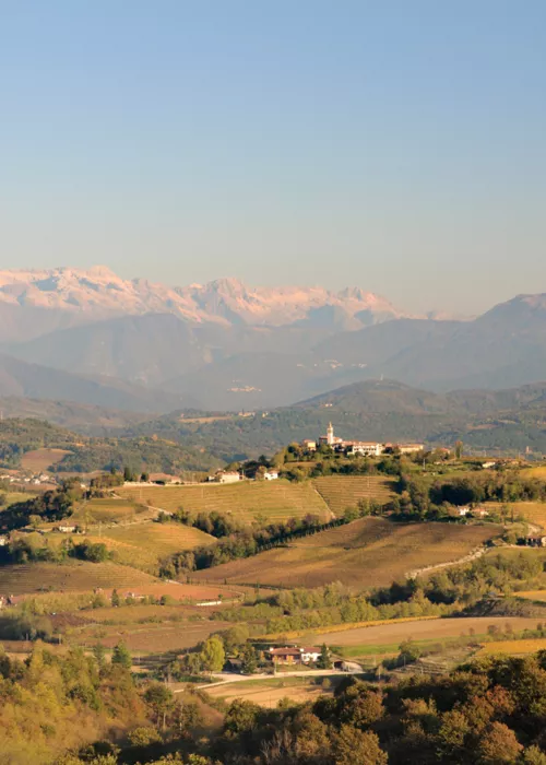
The next stop takes you back to Slovenia, but first you cross the Colli Orientali del Friuli, one of the most famous and internationally renowned wine-growing areas. Famous native white wines are produced here, such as Ramandolo, one of the oldest vines in Friuli, and Picolit, a wine of unparalleled elegance and delicacy, or Pignolo, a great red wine rich in tones and nuances.
Collio
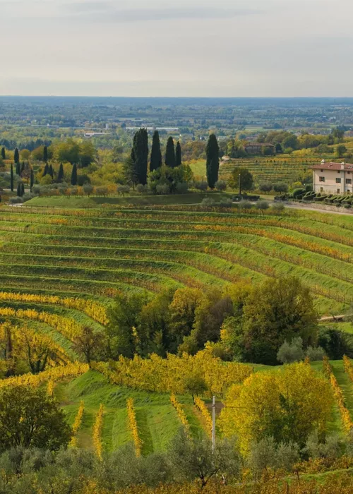
The wines from the next Italian stop, which leads to Collio Goriziano, are also among the best in the world. The area, which was once characterised by oak trees, now extends over large terraced vineyards cultivated on the southern slopes, where excellent white wines and high-quality red wines are produced. The economic and cultural centre of Collio is Cormons, also known for another gastronomic speciality, a typical sweet raw ham, delicately smoked with cherry and bay leaves.
Beyond the hills lies Gradisca d'Isonzo, a small town surrounded by greenery and ready to tell a story spanning over nine centuries. Located along the Isonzo valley, it is in a strategic position, which is why Gradisca took on the appearance of a real fortress in the past. Initially a bulwark defending the domains of the Republic of Venice against Turkish raids, in the 17th century it came under Austrian influence, becoming the capital of a new county and enriched with palaces that still stand today.
Leaving Gradisca in the direction of the Karst, you cross the Isonzo, the undisputed protagonist of this territory from both a geographical and historical point of view. It is a river with emerald waters and is historically associated with the First World War due to the twelve battles that bear its name and which left numerous traces still visible in the area.
The Karst
The Karst is home to one of the most significant sites of the First World War, the Monte San Michele Open-Air Museum, consisting of a labyrinth of trenches, walkways and fortifications. But in addition to its historical significance, the Karst is a particularly valuable area from a naturalistic point of view. Due to its geomorphological features, caves, sinkholes and valleys carved into the rock by water and underground rivers, the area is a paradise for geologists and, thanks to its extraordinary variety of vegetation, for botanists. Here, underground watercourses from the Isonzo basin emerge, forming exceptional karst lakes, such as those of Doberdò and Pietrarossa.
The Karst is criss-crossed by many other paths, including one that was much loved by the poet Rainer Maria Rilke and is dedicated to him for this very reason. The walk runs along the bay of Sistiana, enters the pine forest and then opens up to a view of Duino Castle, framed by the unique cliffs of the Adriatic. The route is dotted with unforgettable viewpoints from which, weather permitting, you can see the Carnic Pre-Alps, the Grado lagoon and the Istrian coast. Continuing inland, you find yourself immersed in vegetation among holm oaks, oaks, ash trees, broom and sumac. Here you can stop at traditional osmize, wine cellars where you can taste local wines and products: the Karst region produces native wines such as Terrano, with its typical ruby red colour and fruity bouquet, the elegant Vitovska and Malvasia with its fresh, dry taste. A little further on is the small village of Prosecco, which gives its name to one of the most famous sparkling wines in the world, and a short distance away is the Grotta Gigante, one of the largest karst caves in Europe open to visitors.
Just below Prosecco, directly on the sea, is the spectacular Miramare Castle, once the residence of Archduke Ferdinand Maximilian of Habsburg and his wife Charlotte of Belgium. From this point, the route turns inland again and crosses a valley of great naturalistic importance, because it represents an exception to the context: the Rosandra Valley. Here flows the only surface watercourse in the Trieste Karst, which is otherwise characterised by the fact that it has no surface hydrographic network, but only an underground one. Another peculiarity of the valley is the sudden transition from a subalpine continental climate to a Mediterranean one. The climatic and thermal differences make the Val Rosandra rich in microclimates and, consequently, in unique flora and fauna.
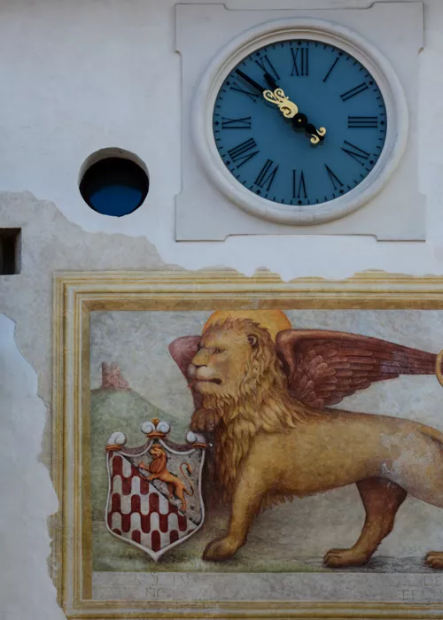
One last walk in Slovenian territory and you finally reach the Adriatic Sea. Overlooking a small dock at the foot of the hills, in an area that is geographically already Istria, Muggia is the last strip of Italian land to the east. Its historical link with Venice is evident: picturesque streets, the Gothic-Venetian cathedral, the town hall with its façade adorned with the Lions of St. Mark and the coats of arms of the ancient noble families of Muggia.


